Today our world is facing serious challenges, and it’s clear that we need to work together to collectively create a better future.
We don’t really have a lot of choice in this matter. We need to leverage our very best brains, our best creative talent,
our best design talent, our technology, and our science, and use it to create a more sustainable future.
It’s a big challenge–by its very nature, a geographic challenge–that will require a lot of GIS talent. GIS changes how we think
and how we act. It’s transformational and also integrates geographic science into everything we do–what we measure, how we analyze
things, what predictions we make, how we plan, how we design, how we evaluate, and ultimately how we manage it over time. GIS is already
helping us to understand things. It provides a framework for transforming the world through all kinds of activities. But to meet the
geographic challenges we face, we need to also fundamentally transform GIS itself.
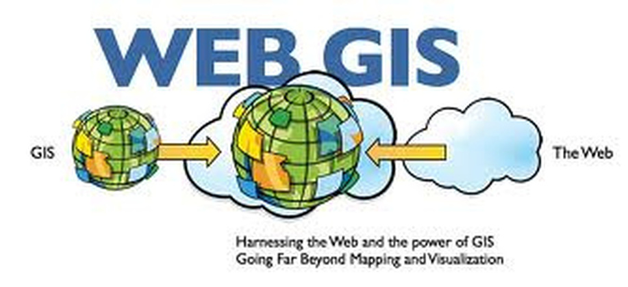
GIS in a web environment, or web GIS, can of course represent all of the typical data types–maps, imagery, and different kinds of GIS services. But it’s increasingly able to bring in new kinds of data–tabular data, enterprise data, spreadsheet data, big SAP databases, etc.
It can also integrate social media and sensor networks, real-time information, and more recently, the whole world of big data, providing a new medium for understanding. Today GIS Companies in india working to improvise web technology to garner better information for Goverment institutions and for other businesses.
Web GIS also provides a new pattern for integration. Traditionally, GIS was all about the geodatabase;
we very carefully integrated all of our data into the geodatabase. That’s really important work, and most of you have done
that kind of work. But web GIS represents a fundamentally different pattern. It means that we can integrate things dynamically
from distributed services, using web services and web maps. And this enables a more flexible and more agile approach.
We at Infotech Enterprises at present holds extensive map coverage for technical applications including Air Dispersion Modeling, Human Health & Ecological Risk Assessment and Terrain Processing. These maps are ready for download in various formats, to facilitate your modeling.
Contact us for more Information.