We are going to show you how to work with Maps.
Following are the point.
1. Map basic elements 2. Additional graphics elements 3. Map finalization
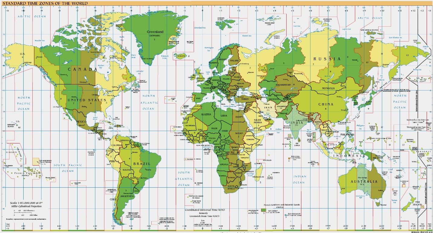
Map Basic element:-Definition of Map Elements. A map usually contains the following elements: Title (and subtitle): Usually draws attention by virtue of its dominant size; serves to focus attention on the primary content of the map.
- Title the heading of a map
- Compass a part of a map that shows the cardinal directions/other directions (north arrow).
- Key a part of a map used to define symbols on the map and easily find the locations.
- Grid the horizontal and vertical set of lines that show coordinates values on a map.
- Scale the part of the map used to show how big it is in actual size small and large maps adjust in required paper size.
Additional graphics elements:- Maps are the primary tools by which spatial relationships are visualized and analyze . Maps are important documents. There are several key elements that should be included each time a map is created in order to aid the viewer in understanding the communications of that map and to document the source of the geographic information used.
1. Data frame 2. Legend 3. Title 4. North Arrow 5. Scale 6. Citation 7. Grid 8. Key map
Map finalization:-
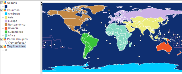
- You can turn off some map layers for data that we do not need for this map. Un-check the box next to extra layers. Before we make a map suitable for printing, we need to choose an appropriate projection. This dataset comes in Geographic Coordinate System (GCS) where the units are degrees. This is not appropriate for a map where you want the distances to be in kilometers or miles. We need to use a Projected Coordinate System that minimizes distortions for our region of interest and has units in meters. Universal Transverse Mercator (UTM) is a decent choice for a projected coordinate system. It is also global, so it’s a good default that you can rely on and choose a UTM zone that contains your area of interest to minimize distortions for your region.
- Once you are satisfied with the map, you can export it as Image, PDF or SVG. For this tutorial, let’s export it as an image. Click Composer ‣ Export as Image.
- Save the image in the format of your liking. Below is the exported PNG image.
At InfoTech Enterprises, We are renowned as Top LiDAR Companies in India. As a GIS, CAD, LiDAR and Photogrammetry company we offers a wide range of mapping and drafting services such for various industry verticals to
customers worldwide. Our main services provided includes data conversion, drafting , navigation, engineering, architectural and mechanical drawings.