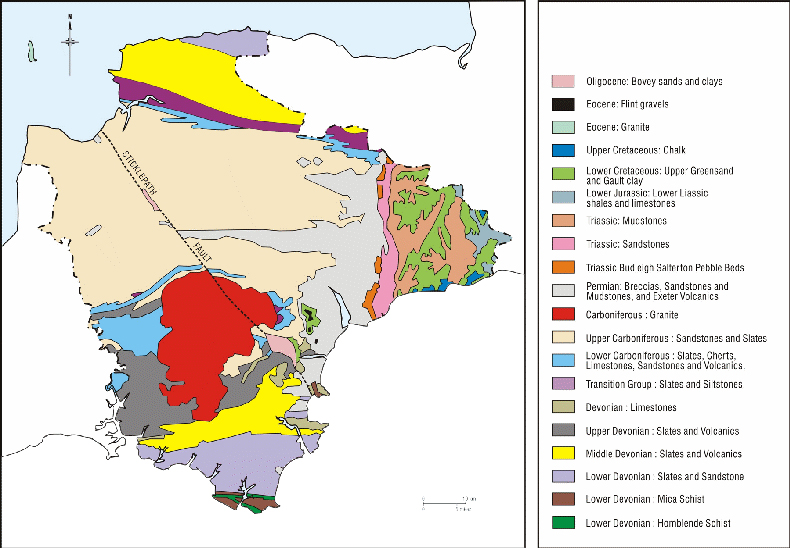
Geologic maps graphically communicate vast amounts of geologic information. A geologic map represents the projection on a flat piece of paper of the intersection between geological 3D features with the surface topography with the added benefit of depicting the relative age, composition, and relationships among rocks and sediments at and near the earth’s surface.
The contour lines and contour intervals depict elevation / altitude and depth, illustrating the general terrain for an area.
A detailed geological map shows what it is you are standing on and where similar rocks or sediments may be found and how old they are and what they are composed of and how they formed and how they have been affected by faulting, folding or other geologic processes and what existing or potential mineral resources and geologic hazards are nearby.
Geological information shown on maps is necessary for countless reasons, from finding natural resources (water, minerals, oil and gas) to evaluating potential hazards (earthquakes, landslides, floods, volcanic eruptions) to describing a fundamental part of the environment that controls distribution of plants and animals. General purpose geologic maps address all of these themes. However your task is to create a geological map showing lithology and structure.


