InfoTech have state of the art facilities for offering services that covers a wide range of photogrammetric service requirements. Our
services are envisioned to meet the diverse needs of our clientele quickly and efficiently and our project methodologies are based on the
unique set of customer requirements and challenges. Photogrammetry allows you to obtain reliable information and measurements of physical
objects from photographs and use them for development of maps, drawings, or 3D models of terrains. Aerial images require pre- and
post-processing using Photogrammetry before they can be used to extract valuable geo-data. InfoTech offers following Photogrammetry
services:
Our staff of experienced technicians and certified and licensed professionals stands ready to serve client unique project needs.
InfoTech has the equipment and software necessary to offer a wide variety of services and to perform a given project. We maintain careful
control over the processes, assure product accuracy, and keep costs down. Our high-precision Photogrammetry Services are offered at
extremely balanced prices that make us competitive among the other Photogrammetry companies in India. Our services allow accurate
and cost-effective data collection that proves to be an important input for planning and designing of photogrammetry projects.
InfoTech's Aerial Photogrammetric services serve as an excellent tool to support GIS projects by correcting any topographic and
radial distortions in the earth's environment.
Photogrammetric Services
InfoTech is a renowned leader in the field of remote sensing and scientific measurement. We use Spatial Technology and Geographic Information Systems (GIS), and employ the brightest talent in the industry. There is a practical function to all our products and services. Outsourcing a project to us will connect you directly to industry experts who have more than a decade of experience in providing pioneering solutions that are both cost-effective and valuable.
Our advanced photogrammetry division enables us to capture data from small to large scale stereo models and generate digital topographic maps of high precision.
Our photogrammetry services are popular across various industries from transportation to land administration, and aerial acquisition to digital orthophotography. We have the necessary software and knowledge to cater to utility companies and those involved in geological mapping as well.
The existing methods are grouped into three categories: 3D reconstruction from images, 3D modeling using range data, and 3D modeling using images and range data.
Our extensive experience ensures complete control and accuracy in processes, while maintaining low costs. InfoTech has a team of experienced technicians and certified licensed professionals who have the industry expertise necessary to deliver superior products and services efficiently, in promised time.
We offer the Following Photogrammetric Services
Aerial photogrammetry services for new aerial photographs to update existing planimetric data
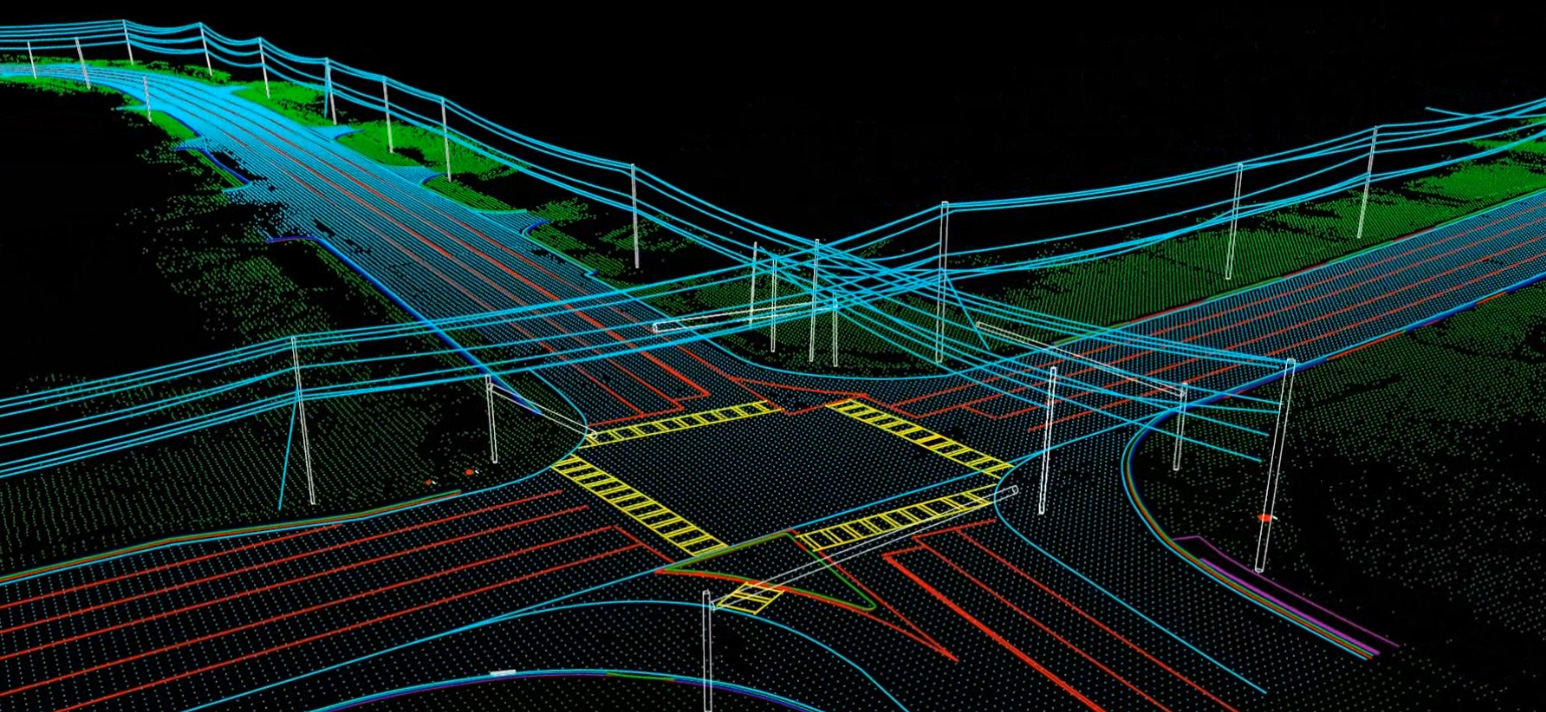
Highway corridor mapping
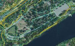
Planimetric mapping of railway, roads, buildings, and vegetation
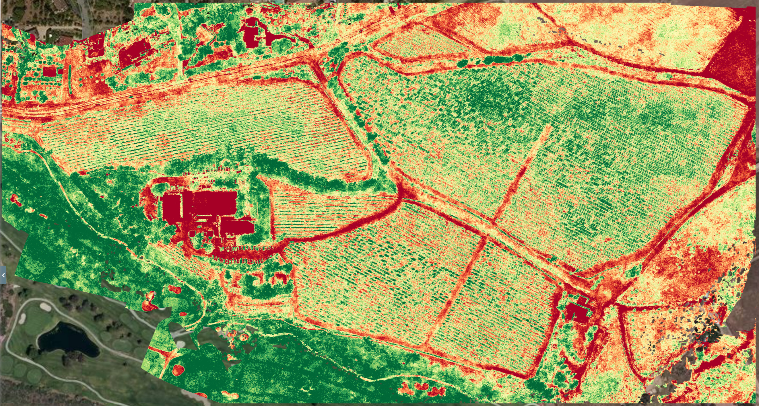
Orthophoto production and contour generation with Digital Elevation Model (DEM) collection
DEM or 3D Collection and Orthophoto production for the International Airports' Aviation Features
The creation of digital terrain models and digital surface models with DEM collection
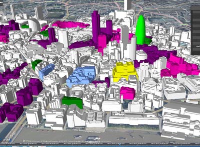
Construction of high definition digital topographic maps
The use photogrammetric services to texture 3D Objects from AutoCAD files
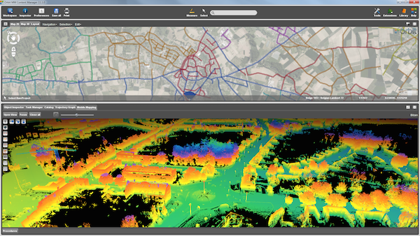
Update and produce high resolution contour mapping with stereo editing of LiDAR points
Clear Satellite Tracker (iSAT) images using Aero Triangulation and Bundle Block Adjustment
Benefits of Outsourcing Photogrammetric Services to InfoTech
Our photogrammetry and aerial photogrammetry specialists have vast experience in using the latest technology, maintaining industry standards (our photogrammetry systems can accurately map terrain within 2 Feet)
InfoTech is able to produce digital topographic maps with scales up to 1:100000, so if your project requires high definition topographic maps, we can help!
There are certain processes which are following before deliveries.
1.Interpolation of height at any terrain point.
2.Plots of contours with user-specified contour intervals.
3.Generation of longitudinal and cross section profiles.
4.Plots of isometric and perspective images.
5.Volume calculations, including computation of cut and fill.
We can finish projects quickly and efficiently because we are experts in 3D modelling and creating planimetric features for structures
When it comes to the size of the photogrammetric projects we can handle, we have no limitations (we have successfully executed Photogrammetric projects totaling an area more than 2 million square kilometers)
All our work is put through multiple quality control procedures, as a result you will receive a product that is of the highest possible quality
Outsource Photogrammetric Services to InfoTech
Our vast experience in the field has made us realize that most companies and government agencies do not pursue their photogrammetry needs due to budgetary constraints. However, we have found that when they call InfoTech, they are always amazed at our cost-effective services and professional services.
Even though no other company can match our combined skills and experience in photogrammetry, we aim to serve all our customers resourcefully and economically. Achieve your targets efficiently by outsourcing Photogrammetric services to us.