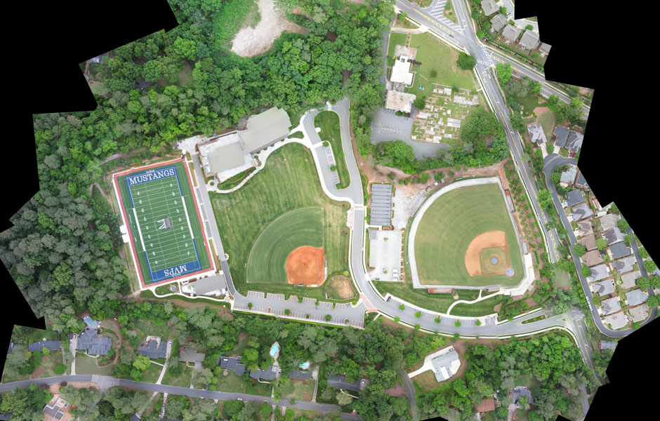
Drones have allowed high-quality 3D mapping data to become much more accessible. This enables better management, faster and more informed decision making, and provides an accurate high-resolution archival record of every inch of your site.
Drones provide the ability to capture on-demand maps for a fraction of the cost of traditional approaches using manned aircraft and at a much higher resolution than satellites. Unlike satellite data we operate on an on-demand basis, and our drones fly quite low and so aren’t affected by cloud.
These outputs are fully geo-referenced and ortho-rectified, meaning measurements and calculations can be taken directly from them. This can be anything from basic distance, area and slope calculations right up to stockpile volume analysis, sight lines or watershed runoff simulations.
To create 3D maps from aerial photogrammetry, the camera is mounted on the drone and is usually pointed vertically towards the ground. Using photogrammetry to create 3D models of monuments or statues, the camera is mounted horizontally on the UAV.
Multiple overlapping photos (80 to 90% overlap) of the ground or model are taken as the UAV flies along an autonomous programmed flight path called a waypoint. To overlap photos of an object or land by 80 to 90% would be impossible to complete accurately by pilot navigation. It is essential to have a UAV which has waypoint Navigation technology.
As far as in UAV LiDAR involves mounting a laser scanner on a UAV to measure the height of points in the landscape below the UAV.
The accuracy of the measurements allows the 3D models created to be used in any planning, design, and decision making processes across many sectors.
LiDAR sensors can also pierce dense canopy and vegetation, making it possible to capture bare earth structure that satellites cannot see, as well as ground cover in enough detail to allow vegetation categorization and change monitoring.


