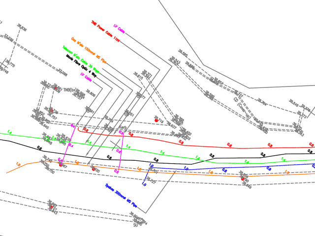
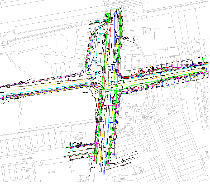
InfoTech offers utility mapping services and field data capturing of utility networks such as electrical, water, gas, sewage & telecom. Basically major investments need to be made in society’s utility supply lines; Water mains, sewage systems, telephone lines, power lines, gas mains, etc. Often the geographic location is recorded on inferior quality maps and in some cases & it is not documented at all. Certainty of supply, environmental protection and efficiency of operations, however require good basic data. Also quarry damage can be largely avoided when reliable information regarding location and description of underground utility lines are available. Repair and replacement of utility lines can be carried out in the optimal manner when based on an efficient GIS/utility mapping system.
We've highly skilled technicians who specialize in digitally recording important overhead as well as underground assets in detail. Possessing in-depth experience in digital documentation and unquestioned dedication, we assure our clients of supreme quality services according to their particular needs.
When it comes to our utility mapping service, we cover quite a few sections such as system modeling, land base creation, raster to vector map conversion, work order updates and circuit map creation. Top-grade software applications like AutoCAD and MicroStation are used to execute these activities. Our experts mix the technologies of digital mapping from various sources such as satellite pictures, aerial photographs, existing maps and GPS field data to generate the GIS database.
InfoTech provides custom and high quality utility mapping solutions for Transmission and distribution lines from LiDAR Data and Aerial Photography,
Through our extensive experience, we have developed our own processing and QA techniques to provide you better and faster results for 3D network design, vegetation management, clearance distances or PLS-CADD modeling among others.


