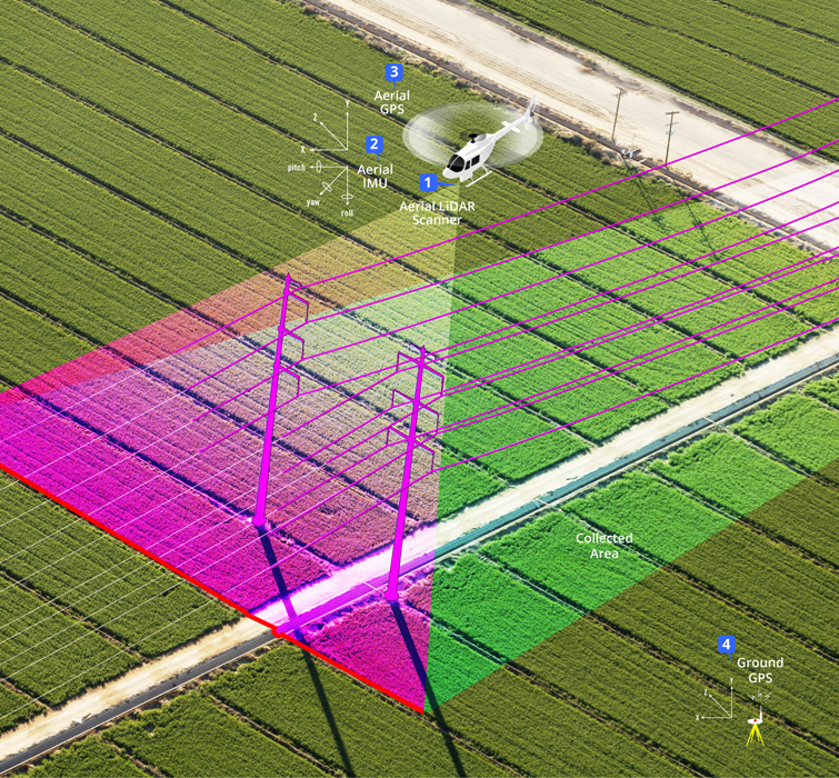
LiDAR (Light Detection and Ranging) is technology developed for creating highly accurate, three-dimensional surveys of terrain, vegetation and electric utility infrastructure. Close-range LiDAR data is classified as having the sensor positioned at distances ranging from 500′ to 1500′ from the features to be acquired. The acquisition for modeling can be accomplished from the air or ground. Close-range aerial LiDAR is typically collected from a helicopter platform and can yield x,y,z point densities of 25 to 40 per square meter. Static terrestrial scanners and kinematic mobile mapping systems collect the LiDAR data and image data from ground perspectives at densities ranging from 500 to 2000 points per square meter. These LiDAR collection technologies can be deployed independently, or in tandem for effective electric transmission corridor mapping.
Utility Corridor mapping is basically used for Electricity sagging, tele-communication, oil and gas etc.
Now-a-days the mapping is doing in Photogrammetry by using UAV due to cost effective and high accuracy.
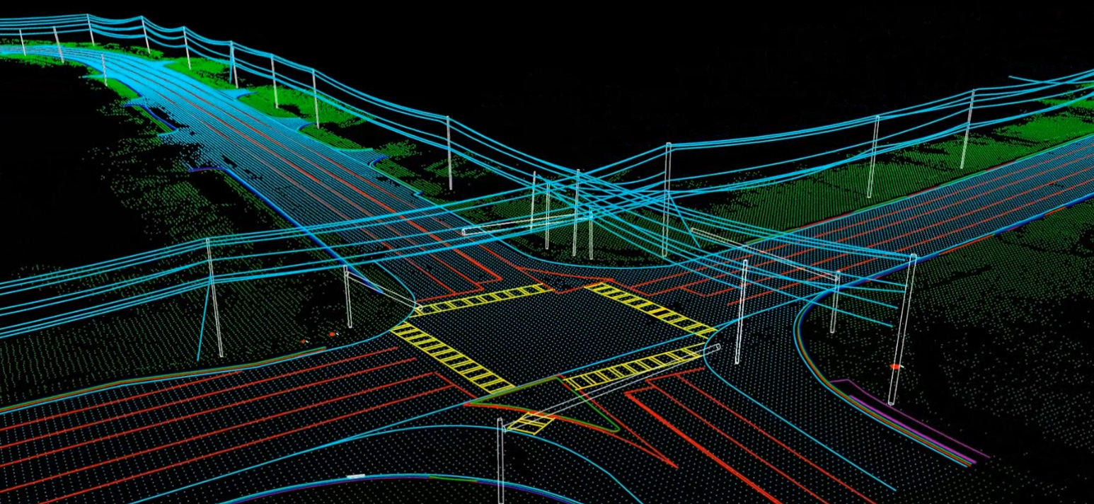
It is basically using for road development, railway development and Hydrological surveys etc. It admirations measurement of the corridor using air laser scanning in LiDAR and UAV/ Aero photography in Photogrammetry. High density of points in a point cloud, a low ceiling and high-resolution digital photos from multiple perspectives enable making the inventory of the objects on the traffic lane, their visualization, measurements and the analysis of transverse and longitudinal surface slopping effect. Digital terrain model (DTM) and digital surface model (DSM), which are the results of laser scanning, make it possible to generate elevation profiles in any place and to model the nosey effects.
Crop monitoring, crop acreages estimation, agro meteorological modeling, crop yield forecasting, subsidy control, precision farming etc. are normal forms to use. Basically for this, clients gave us LiDAR data and we need to extract as per requirement. Now days so many of


